Cloudy skies ruining your satellite scenes? SAR vs optical imagery comes down to this: radar images through cloud and darkness, while optical gives you colour and the finest detail.
This comparison is part of our wider coverage of satellite imagery, and it sticks to how the two sensor types differ in practice.
| Item | Value |
|---|---|
| Best commercial optical resolution | Up to 30 cm |
| Visible light range | 0.39 to 0.70 μm |
| Infrared range open to observation | 0.70 to 14 μm |
| Typical SAR wavelength | A few to tens of centimeters |
| Radar beam width (10 centimeters wavelength, 10 meters antenna) | 1/100 radians (0.6 degrees) |
These figures come from the ESA Newcomers Earth Observation Guide and NASA’s overview of SAR; they can change, so check the source before you rely on them.
How the two sensors collect an image
Optical sensors are passive: they record sunlight reflected from the ground, or heat the surface gives off. ESA’s guide notes that passive imagery usually depends on the day-night cycle and can be degraded or blocked by cloud cover, as set out in the Newcomers Earth Observation Guide.
Radar is active. According to ESA’s page on SAR missions, it transmits a beam of radiation in the microwave region of the electromagnetic spectrum, so it works independently of light and heat.
The two approaches differ in three practical ways:
- Energy source: an optical sensor waits for the sun, while a radar supplies its own signal.
- What a pixel means: optical pixels record brightness in chosen colours. Radar pixels are built from the strength and time delay of the returned signal, which depends mainly on surface roughness and electrical properties, as NASA explains.
- Wavelengths: the atmosphere lets optical sensors observe visible light at 0.39 to 0.70 μm and infrared at 0.70 to 14 μm, per the ESA guide. Remote sensing radars use microwaves of a few to tens of centimeters, per NASA.
Radar needs the synthetic aperture technique because a beam spreads on its way down. NASA’s example is a signal wavelength of 10 centimeters with an antenna of 10 meters in diameter, which gives a beam width of 1/100 radians (0.6 degrees), as described on NASA’s SAR page.
Where radar has the advantage
The headline benefit is weather independence. ESA states that clouds, fog and precipitation do not have any significant effect on microwaves, so SAR images can be acquired whatever the weather, day or night, on its SAR missions page.
The Copernicus Data Space Ecosystem makes the same point about Sentinel-1: radar imagery can penetrate clouds and is unaffected by lighting conditions. It calls this especially vital for regions with frequent cloud cover and for low-sunlight periods such as winter months or polar regions, in its announcement of monthly mosaics.
Radar also suits repeat monitoring. Sentinel-1 operates at C-band to provide medium-resolution imagery, and its wide swath offers fast global coverage, according to ESA.
Because the signal is consistent from one pass to the next, backscatter measurements let analysts detect surface changes over time, such as deforestation, ice sheet dynamics and soil moisture variations, as the Copernicus post describes.
Where optical imagery wins
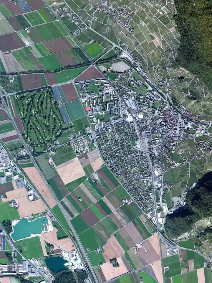
Optical data is the one you can read at a glance. A natural-colour image combines measurements in three visible bands, in the same way as a classical consumer camera, as the ESA guide explains.
It also leads on fine detail. The best commercially available satellite instruments reach up to 30 cm resolution in panchromatic mode, according to the same ESA guide. Pan-sharpening then merges multi-spectral and panchromatic images to give high-resolution coloured pictures.
Optical sensors can also separate surface types by colour and near-infrared response. In a false-colour view, healthy vegetation creates chlorophyll, which reflects near-infrared energy and therefore appears in darker red, per the ESA guide.
Many other wavelength recipes exist for floods, burn scars, snow and ice, so our explainer on satellite imagery band combinations is a useful next read.
What working with radar data demands
A radar scene is not a picture you can drop into a map. The Copernicus team describes SAR data as highly complex, needing significant preprocessing before analysis, in its Sentinel-1 mosaics announcement.
Typical steps include:
- Calibration, to remove sensor noise.
- Radiometric terrain correction, to adjust for topographic effects.
- Orthorectification, to ensure spatial accuracy.
The same post adds that this processing is computationally intensive and needs remote sensing expertise. To lower that barrier, the Copernicus platform added Sentinel-1 monthly mosaics; as of its August 6, 2024 post, they covered the full year of 2023, so check the announcement for later coverage.
Which sensor should you pick for your project?
Start from your constraint, not from the sensor. Use these rules of thumb, which follow from the sources above:
- Persistent cloud, polar winters or night-time acquisitions point to radar.
- Vegetation health, colour interpretation or the sharpest ground detail point to optical.
- Tracking change over many months points to radar time series, if you can handle the preprocessing.
- A quick visual check for a non-specialist audience points to a natural-colour optical image.
Because optical sensing struggles with cloud and darkness while radar does not, pairing the two can cover each other’s gaps. For the next step, read our Sentinel vs Landsat comparison of two widely used imagery programmes.
Frequently asked questions
Can radar see through clouds?
Show answer
Yes, for practical purposes. The microwave signal passes through cloud and fog, which is why radar suits places where optical scenes keep coming back covered.
Does radar produce colour images?
Show answer
Not like a camera does. A radar image is built from the strength and delay of the returned signal, so colour in a radar map is a display choice made during processing.
Is optical imagery useless at night?
Show answer
Visible imagery depends on reflected sunlight, so it can only be obtained in daylight. Thermal infrared is the exception: the Earth and clouds emit it constantly, so IR scenes can be captured when the sun is not shining, per the ESA guide.
What does SAR actually stand for?
Show answer
It stands for synthetic aperture radar, a technique that produces fine-resolution images from a radar system that would otherwise be resolution-limited. NASA notes the radar must move in a straight line, either on an airplane or orbiting in space, on its SAR overview.